Introduction
Traditional land surveying has supported industries like construction, mining, and infrastructure for decades, but the process is often slow, labor-intensive, and expensive. Large land surveys can take several days or even weeks, especially when teams need to access hazardous or remote locations. In industries where project delays directly affect budgets and deadlines, these limitations create serious operational challenges.
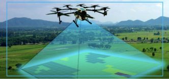
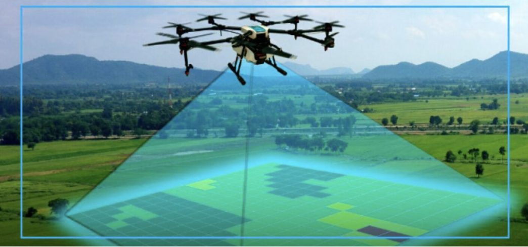
Drone 3D scanning is changing that model completely. Instead of sending multiple surveyors into the field with conventional equipment, companies now deploy drones equipped with advanced cameras, LiDAR sensors, and GPS systems to capture high-accuracy site data within hours.
This shift comes at the right time. The global drone surveying market continues to expand rapidly as businesses search for faster and more reliable data collection methods. Market analysts project strong growth in drone mapping and surveying services through 2035, driven by increasing adoption in construction, energy, mining, and public infrastructure projects.
Drone 3D scanning services involve using unmanned aerial vehicles to collect aerial imagery or laser-based measurements and convert them into digital assets such as orthomosaic maps, 3D models, point clouds, and terrain data. These deliverables help project managers make faster decisions while reducing operational risk.
From aerial 3D mapping for construction progress tracking to specialized drone archaeology services for preserving ancient ruins, drone technology is no longer an emerging tool—it is becoming an industry standard.
This article explores how drone 3D scanning works, the technologies behind it, its biggest benefits, major industry applications, and what the future looks like beyond 2026.
What Are Drone 3D Scanning Services?
Drone 3D scanning services use UAVs to capture detailed geographic and structural data from above. A drone follows a predefined flight path while collecting imagery, laser measurements, or thermal data across a project site.
The collected information is later processed through specialized software that converts raw files into practical outputs such as digital surface models, point clouds, 3D meshes, CAD files, and orthomosaic maps.
The process usually begins with flight planning. Operators define the survey area, flight altitude, overlap percentages, and mission parameters. Once deployed, the drone captures hundreds or thousands of data points during flight.
Modern drone systems commonly use high-resolution RGB cameras, LiDAR scanners, GPS modules, and RTK or PPK positioning systems. These tools improve both accuracy and repeatability.
After the flight, the data enters processing software where algorithms stitch images together or organize laser returns into measurable datasets. Final deliverables vary depending on project requirements, but most clients receive files compatible with CAD, BIM, GIS, or modeling platforms.
Some projects prioritize real-time results for rapid decision-making, while others use post-processing workflows for maximum precision.
Key Technologies Powering Drone Scanning
The effectiveness of drone surveying services depends heavily on sensor technology.
LiDAR remains one of the most powerful scanning tools available. It works by sending laser pulses toward surfaces and measuring the time required for each pulse to return. This allows drones to generate extremely dense and accurate point clouds.
LiDAR performs especially well in complex terrain and vegetated areas because laser pulses can penetrate gaps in tree canopies. This makes it ideal for forestry, utility corridor mapping, mining, and topographic surveys.
Photogrammetry offers a different approach. Instead of lasers, it uses overlapping images captured from multiple angles. Software analyzes these images and reconstructs 3D geometry by matching shared visual points.
Photogrammetry is generally more affordable than LiDAR and produces excellent texture detail. It is widely used for architecture, construction documentation, real estate visualization, and archaeology.
Thermal imaging has also expanded drone capabilities. Thermal sensors detect heat differences across surfaces, enabling use cases such as solar panel inspection, roof diagnostics, pipeline monitoring, and environmental analysis.
Artificial intelligence is becoming increasingly important in drone scanning workflows. AI automates object recognition, terrain classification, anomaly detection, and quality control. It significantly reduces processing time while improving data consistency.
The future likely belongs to multi-sensor drones capable of combining RGB, LiDAR, thermal, and multispectral data in a single mission.
Major Benefits of Adopting Drone 3D Scanning Services
The most obvious benefit of drone 3D scanning is speed.
A traditional 100-acre land survey may require several days of fieldwork with multiple personnel. The same area can often be captured by a drone in less than a day. Depending on project complexity, businesses commonly report time savings between 50% and 80%.
Faster data collection directly accelerates project timelines. Teams receive site information sooner, which improves planning, reduces bottlenecks, and supports faster approvals.
Accuracy is another major advantage. Modern drone systems equipped with RTK or PPK technology routinely achieve centimeter-level precision. This level of accuracy supports advanced workflows such as cut-and-fill calculations, stockpile volume measurement, as-built verification, and digital twin generation.
Drone scanning also improves safety. Many surveys involve dangerous environments such as open-pit mines, unstable slopes, rooftops, bridges, power infrastructure, or archaeological ruins.
Instead of exposing field teams to physical risk, drones capture data remotely. This reduces accident exposure while maintaining data quality.
Cost savings further strengthen the business case. Drone operations typically require fewer personnel, less field time, and reduced equipment overhead.
Companies adopting drone surveying services often report cost reductions between 40% and 70%, depending on project scale and frequency.
For recurring projects, return on investment becomes even stronger due to repeated efficiency gains.
Industries Benefiting Most from Drone 3D Scanning Services
Construction companies are among the largest adopters of drone scanning technology. They use aerial 3D mapping to monitor project progress, calculate earthwork volumes, compare as-built conditions against design models, and integrate site data into BIM workflows.
Real estate developers and architects use drone-generated models for site analysis, design visualization, and immersive client presentations. Virtual tours and high-quality 3D site models improve communication during development phases.
Mining and aggregates operations depend on drone scanning for stockpile measurements, pit progression analysis, haul road planning, and safety monitoring. Accurate volume calculations reduce inventory uncertainty.
Energy and utilities companies use drones to inspect power lines, solar farms, substations, wind turbines, and pipelines. Drone-based inspections reduce downtime while improving inspection coverage.
Agriculture also benefits significantly. Farmers and consultants use drone data to monitor crop health, drainage, soil conditions, and irrigation efficiency. Environmental agencies apply similar workflows to flood modeling, erosion monitoring, and habitat assessment.
Drone archaeology services represent a growing niche with high value.
Archaeologists increasingly use drones to document historical sites without disturbing fragile structures. High-resolution photogrammetry enables precise 3D reconstruction of ruins, excavation areas, and artifacts.
These models support excavation planning, digital preservation, and museum visualization.
In Egypt, drone mapping has been used to document ancient settlements and archaeological landscapes. Similar methods are expanding globally as heritage organizations prioritize preservation.
Drone 3D Scanning vs Traditional Surveying Methods
Traditional surveying still plays an important role in many projects, but drone scanning introduces clear operational advantages.
Conventional methods require physical access to measurement points. This limits efficiency in hazardous or inaccessible areas.
Drone scanning removes many of these constraints by collecting dense datasets remotely.
Traditional surveys often provide smaller datasets focused on specific measurements. Drone workflows capture complete site conditions, enabling richer analysis and repeatable measurements after the flight.
For large-scale projects, drone 3D scanning delivers superior speed, lower costs, stronger safety performance, and more flexible outputs.
LiDAR vs Photogrammetry in Drone Scanning
LiDAR and photogrammetry each serve distinct purposes.
LiDAR is best for projects requiring terrain penetration, high elevation accuracy, and vegetation analysis. It performs well in forests, corridor mapping, mining, and infrastructure surveys.
Its main limitation is cost. LiDAR hardware is significantly more expensive than camera-based systems.
Photogrammetry is ideal for projects where visual realism matters. It creates highly detailed textured models that support construction documentation, architecture, marketing, and archaeological preservation.
Its limitations include reduced performance in poor lighting conditions and difficulty capturing featureless surfaces.
Choosing between LiDAR and photogrammetry depends on project objectives, terrain, budget, and output requirements.
In many cases, hybrid workflows combine both technologies for stronger results.
How to Choose the Right Drone 3D Scanning Service Provider
Not all providers offer the same level of quality.
Experience matters significantly. Businesses should review project portfolios to verify industry expertise.
Providers should also hold relevant certifications and comply with local drone regulations.
Software capabilities are equally important. High-quality deliverables require strong processing workflows and compatibility with client systems.
Accuracy guarantees should be clearly defined before project launch.
Pricing should be transparent, but cost alone should not drive provider selection. Data quality and reliability have much greater long-term value.
Future Trends in Drone 3D Scanning Services
Drone scanning is evolving quickly.
AI automation will continue reducing manual processing time while improving analytics quality.
Autonomous drone fleets and BVLOS operations will expand survey coverage for large-scale infrastructure projects.
Cloud-based workflows will improve collaboration by enabling real-time data sharing across distributed teams.
Digital twins will become standard across smart cities, infrastructure management, and industrial operations.
Drone archaeology services are also expected to expand as museums, researchers, and governments invest more heavily in cultural preservation.
Sustainability initiatives will create additional demand for environmental mapping, carbon monitoring, and land-use analysis.
Conclusion
Drone 3D scanning services are transforming modern surveying by delivering faster data collection, stronger accuracy, lower operational costs, and improved worker safety.
Industries such as construction, mining, energy, agriculture, and archaeology already rely on drone surveying services to improve workflows and reduce risk.
As LiDAR, photogrammetry, AI, and autonomous flight systems continue advancing, aerial 3D mapping will become even more accessible and valuable.
Organizations looking to modernize site analysis, improve project efficiency, or preserve historical assets should strongly consider professional drone 3D scanning services and specialized drone archaeology services as part of their long-term strategy.